World Water Day: Interview with Water Availability Monitor

This year’s World Water Day theme is ‘’valuing water’’.  For InCubed’s activity Water Availability Monitor (WAM), valuing water means providing European farmers with efficient irrigation advice to mitigate drought issues and reduce water use. Find out more in this interview with WAM Project Manager Alexander Hoff and ESA InCubed Programme Manager Amanda Regan.

World Water Day is an annual UN campaign that celebrates water and raises awareness of its use and accessibility. Valuing water, this year’s World Water Day theme is at the core of several InCubed activities including Sat4Flood, CoastEO and WAM.

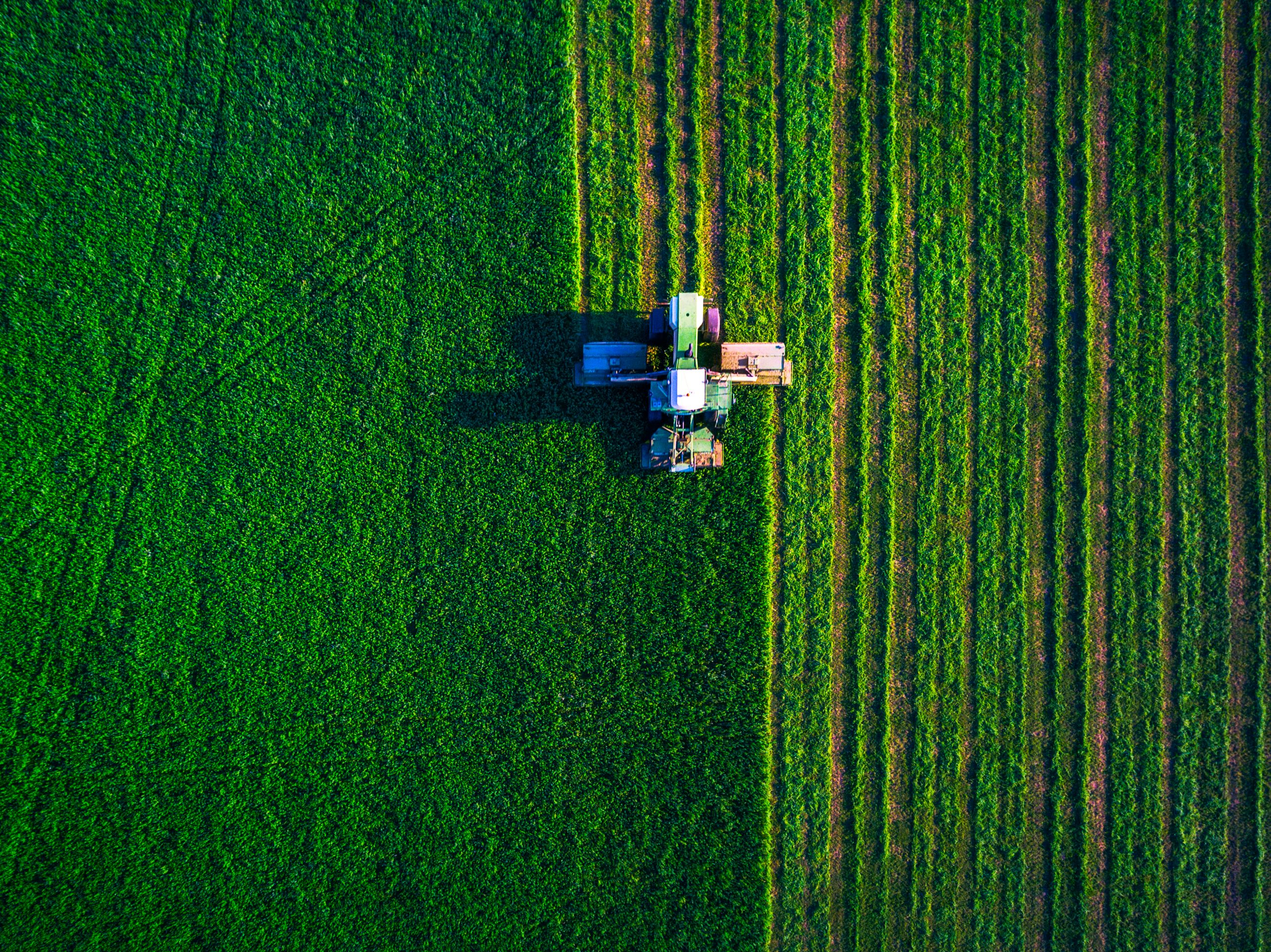
WAM is an information service that provides daily irrigation advice to European farmers, jointly developed by Dutch tech partners Nelen & Schuurmans, AgroVision and VanderSat. Reliable irrigation advice is crucial to ensure high and stable yields, particularly when increasing drought issues are threatening farmers, their income, and food security worldwide. To help mitigate these issues and reduce the use of water in irrigation, WAM uses the best available climatic, soil and crop datasets to provide farmers with effective irrigation advice.

To celebrate World Water Day on Monday 22 March 2021, Alexander Hoff, WAM Project Manager and Business Manager of Integrated Water Management at Nelen & Schuurmans, explained how WAM is helping European farmers value water. Amanda Regan, Head of ESA’s Φ-lab Invest Office and InCubed Programme Manager, also added her point of view, highlighting how the programme can help the European EO industry preserve our Planet.

How does WAM help European farmers use water more efficiently?

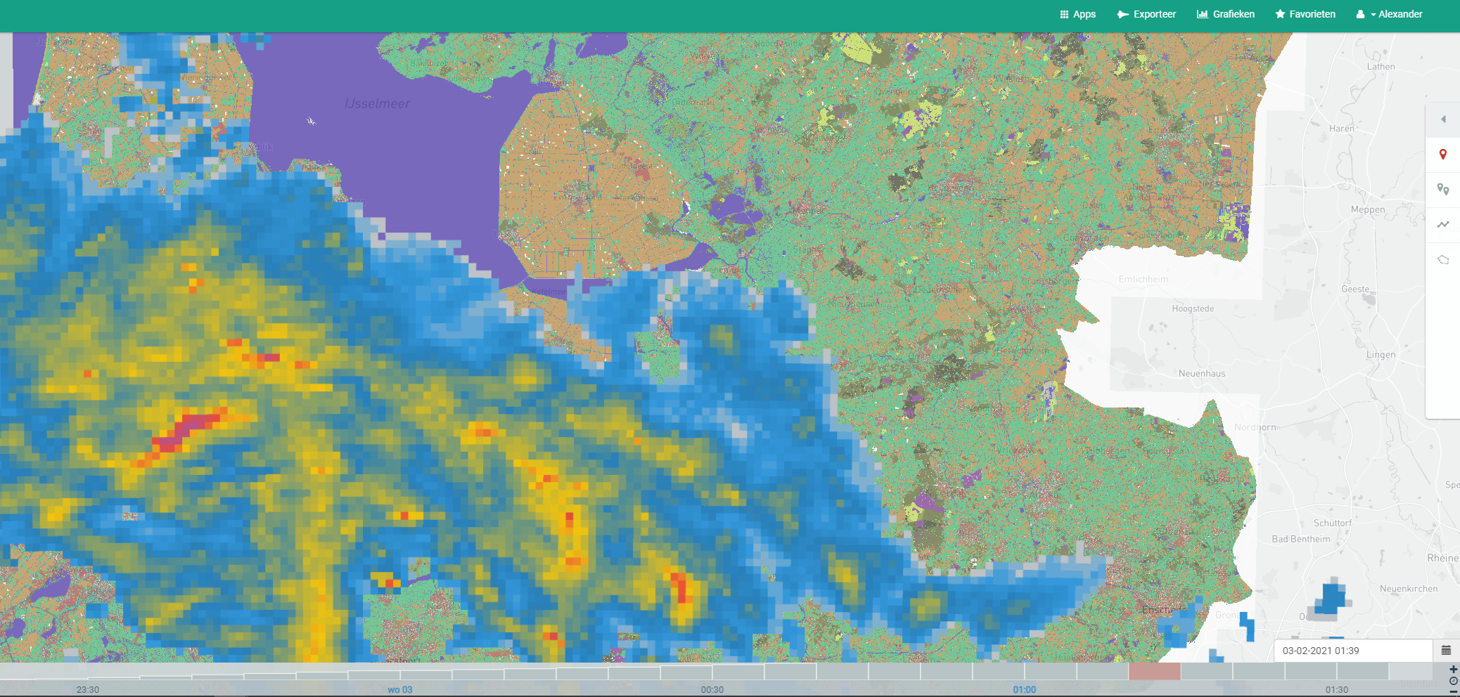
Alexander Hoff: WAM combines satellite data with in-situ sensors and hydrological models to provide actionable irrigation advice. Farmers can access this information using a user-friendly online dashboard called CropVision, developed by AgroVision. This provides farmers with end-to-end irrigation advice that makes the use of irrigation water more efficient, resulting in less unnecessary water use.

How are satellite images used to provide irrigation advice to farmers?

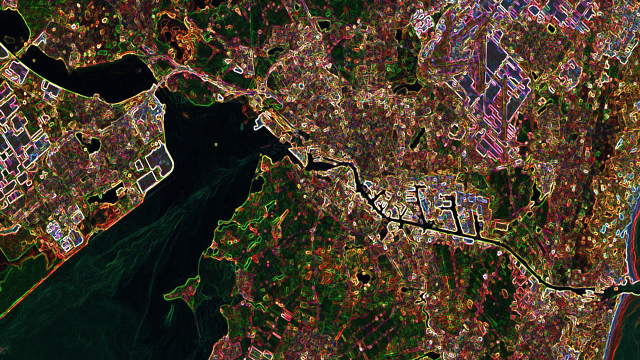
Alexander Hoff: WAM irrigation advice is calculated by a hydrological model, which is driven by VanderSat’s satellite data product. Their world leading soil moisture product provides reliable daily observation at 100-metre resolution. Our hydrological models on plot level use meteorological and hydrological parameters as an input whilst satellite soil moisture observations are used to provide calculations on a daily basis using data assimilation techniques. The soil moisture products are derived from L-band, C-band and X-band microwave sensor observations in orbit on various EO constellations including ESA and NASA.

Amanda Regan: The WAM project, co-funded by ESA InCubed programme, is an example of services that combine multiple sources of EO data, both from optical and radar family, in this case aimed to provide the most advanced parametrisation of the key water availability indices. This highlights the potential of synergistic use of data coming from the Sentinel satellites, but also the added value of integration of this data with other off-the-shelf data products to deliver solutions that are advancing the state-of-the art in the retrieval of this information. On top of this, the ability to prepare data for easy ingestion into the existing farmers’ decision support systems shows how far we have moved from pure EO image analytics to data-driven decision making that can be realistically integrated with end-users systems. 

How has the InCubed programme helped you develop WAM?

Alexander Hoff: Technical assistance and support from the InCubed programme has helped make WAM a reality. The InCubed team have been a great support for the development of our product. Their expertise on remote sensing, EO applications, as well as product and business development have helped us sharpen WAM’s value proposition. Their support throughout the project from proof-of-concept to commercialisation is extraordinary and one of a kind. Information services based on EO have enormous potential to enrich plain data services with spatial and temporal data. However the technological complexity requires larger development investment, which can be challenging for SMEs.  

Amanda Regan: Indeed, InCubed aims at supporting European EO industry to take their products and services to the next level by applying often novel but scientifically validated data analysis methodologies, and commercialising them in a clearly defined market context. WAM project is a test bed of how joining forces and expertise from different fields can lead both to innovation and market uptake. The project is being implemented by a consortium of experienced SMEs that leverage their respective know-how to develop business relationship based on their complementary products and services. The co-funding nature of the InCubed programme means that this business relationship is a long-term investment from all partners involved and will continue even after ESA support will naturally wind down. 

What future plans do you have for WAM?

Alexander Hoff: In 2021, WAM will have its soft launch where selected clients will receive a fully operationally service from start to end of the growing season. This will allow us to technically validate the irrigation advice service throughout the growing season and verify WAM’s value proposition for its clients. After that, we plan to scale up our advice with hundreds of new users per crop growing season. Once this early growth has proven successful, we will expand our service to both Eastern and Southern Europe. Efficient water use is becoming particularly important in Southern Europe where the stresses of climate change are having a severe impact on water availability. For this reason, we have already assessed the usability of WAM in Portugal.  

The topic of this year’s UN World Water Day is “‘valuing water’’. What does water mean to WAM and InCubed?

Alexander Hoff: Water is of course at the core of our activity. We chose to focus on improving irrigation systems because we are convinced that this is arguably the most important natural resource on our planet and we really need to avoid even the smallest waste. We decided to use satellite data for a more sustainable water management, as agriculture is both a victim and part of the solution for increasing drought problems. This concerns available water food production, and directly affects nature and the living environment. So I would say that water is really a central theme in the challenge of climate change, as well as biodiversity.

Amanda Regan: Alexander makes an important point about improving efficiencies in water use which can be transferred to other industries. Water resources management is a global challenge of this century and ESA is fully committed to provide satellite systems of current and next generation to ensure that we have a continuous stream of data to identify and manage these scarce resources. However the success of different management options depends on the ability to trust and apply these EO data in a way which is fully optimised and responding to the needs of the water management authorities, or regulators while taking into account specificities of local conditions as well as, for example, the performance of farming support equipment. Such end-to-end system thinking and the ability to customise solutions to user needs is key. In this decade, we will see a progressive uptake of digital water solutions and, in this context, the InCubed programme allows and encourages the innovators to assess different science and market strategies to address water management issues. Some of them can be developed, demonstrated and delivered through activities like WAM, Sat4Flood and CoastEO. We welcome any ideas that use satellite data to preserve planet Earth.

More information on WAM can be found here.

More information on UN World Water Day can be found here.


Artificial Intelligence powers latest InCubed activity from Planetek Italia

On Wednesday 13 January 2021, Planetek’s AI-express (AIX) platform joined ESA’s InCubed programme with the official kick-off meeting and virtual contract signing. The AIX  Incubed activity will develop a hybrid in-orbit data processing platform powered by Artificial Intelligence (AI) and Blockchain technology.

Planetek’s AIX platform brings a new satellite as-a-service concept to the market and makes on-demand, in-orbit resources such as data and actionable information available to users. AIX will provide an on-board software environment enabling the development of new Earth Observation (EO) based space apps within a user-friendly dedicated store on the ground.

Representatives from ESA’s InCubed programme, Planetek Italia, D-Orbit and AIKO attended the virtual signing earlier this year. On signing the contract, Planetek CEO Giovanni Sylos Labini said: ‘’We are excited to work within ESA’s InCubed programme, with D-Orbit and AIKO, to develop an innovative platform that, thanks to AI and edge-computing, will provide a new generation of Earth Observation tools.’’

With AIx, Planetek supports the space commercial evolution by providing users with a testbed for state-of-the-art technologies, including AI and Blockchain technologies. This hybrid edge ecosystem will give the users EO payloads, ready-to-deploy CubeSats, and software framework infrastructure.

After signing the contract Amanda Regan, Head of the Φ-Lab Invest Office and InCubed Programme Manager, added: ‘’ESA’s InCubed programme is always looking for innovative activities like AIx to exploit state-of-the-art technologies for the benefit of potential customers. We look forward to working with Planetek, De-Orbit and Aiko to shape the future of EO applications and technologies.’’

Planetek has already started InCubed activities, including customer consultation, design trade-offs and prototypal implementations.

The consortium is also organising an online workshop on Wednesday 24 March, 10:30, addressed to interested customers and stakeholders. This will be the occasion to present the product and the specific techonology it uses but also to show the added value of AIx services.

Registrations are opened at https://mc.planetek.it/ai-express_workshop.

More information about the AIX InCubed activity can be found here.

Join the free trial for in1 on Monday 15 March 2021

Does your satellite data suffer from sub-optimal resolution? Find out how InCubed activity in1 can be used to enhance your satellite data at Sobolt’s free two-week virtual trial, starting on Monday 15 March 2021.

AI solutions provider Sobolt joined the Investing in Industrial Innovation (InCubed) programme in February 2020 and has worked to develop state-of-the-art Artificial Data Enhancement (ADE) software called in1.

in1 uses a sophisticated image processing model for unpaired super-resolution to reduce the cost of enhancing satellite data in real-time. The so-called “unpaired” problem consists in super-resolving a low resolution satellite image with AI deep learning techniques, without having a high resolution target image to compare it to. To do so, Sobolt has developed a dedicated state-of-the-art artificial intelligent model that provides potential customers with upgraded data and unlocks exciting new use cases for existing datasets and satellite programmes such as more accurate data analyses. Find out more here.

The free Copernicus Sentinel-2 trial of in1 will start virtually on Monday 15 March 2021 and run for two weeks. Anyone working with Sentinel-2 images can participate in the free trial, using Sobolt’s image library provided on the website or super resolving own images with an API in the cloud. In three easy steps participants will be able to upload an image, enter a short line of code into the API, and finally click on a button to get a higher resolution Sentinel-2 image emerging in a matter of seconds.

This free trial will allow participants to get first-hand experience of in1, be able to evaluate the models performance, and provide valuable feedback. Please register by emailing hello@in1.ai – hurry, only 19 spots available!

Since in1’s intermediate milestone meeting as part of the InCubed programme in December 2020, in1 has been enhancing the sharpness of Copernicus Sentinel-2 images whilst preserving and exceeding Sobolt’s benchmarking for bilinear upsampling. The meeting focused on performance metrics of in1’s original colour definition and how well object edges are defined such as houses and trees.

In1 is a toolbox of AI deep learning functionality focused on improving and enhancing Earth Observation imagery and data sets. This is an innovative software development which pushes the architectural boundaries of deep learning techniques and GPU operational capability. Using a continual improvement approach, Sobolt have developed automatic testing procedures and conducted external peer reviews on every new piece of code added to consistently improve the toolbox.


When: Monday 15 March 2021

Where: Online

To know more and register: Email hello@in1.ai

InCubed co-funds Belgian Aerospacelab to develop Multispectral Companion Mission

ESA’s Investing in Industrial Innovation (InCubed) programme will focus on the development, launch and demonstration of the first Multispectral Companion Satellite prototype of Aerospacelab’s Multispectral Companion Mission whose aim is to provide daily global coverage and commercially focused multispectral data products within a constellation architecture.

The contract was signed during a virtual event on Friday 12 February 2021 by ESA Director of Earth Observation Programmes Josef Aschbacher and the CEO of the Belgian company Aerospacelab Benoit Deper. The event was attended by Thomas Dermine, Belgium Secretary of State, and the Belgium Delegation (including Frank Monteny, the Head of the Belgium Delegation and Steven Bogaerts, the Belgium Programme Board for the Earth Observation delegate). ESA representatives included Giuseppe Borghi, Head of the φ-Lab, Amanda Regan, Head of the Invest Office in the φ-Lab and the InCubed Programme Manager.

The development, launch and demonstration of the first Multispectral Companion Satellite prototype of Aerospacelab’s Multispectral Companion Mission has become the latest activity under ESA’s InCubed programme. The Multispectral Companion Mission (MSCM) is one of two main constellations that Aerospacelab is developing to enhance efficiency and make geospatial intelligence actionable and affordable. Under the InCubed contract, Aerospacelab will develop an In-Orbit prototype.

Representatives from ESA and the InCubed programme, Aerospacelab, Belgium Secretary of State, and the Belgian delegation joined the virtual signing event. On signing the contract Josef Aschbacher, ESA’s Director of Earth Observation Programmes and the agency’s next Director General, said:

‘’ESA is excited to support the European Earth Observation commercial sector and we are looking forward to working with Aerospacelab to develop the first Multispectral Companion Prototype Satellite. The development is commercially focused and is co-funded by the Belgium contribution to InCubed and Aerospacelab. This is one of the biggest InCubed contracts so far, providing an important contribution to the development of the European commercial EO landscape.’’

This demonstration mission will comprise the first satellite of Aerospacelab’s constellation. The aim is to provide a daily global coverage with commercially focused multispectral data products that strive to reach Sentinel-2 specifications for parameters like spectral bands, MTF, SNR, resolution, within the constraints of a cost driven approach. Additional bands will also be investigated, considering the studies performed for Sentinel-2 Next Generation.

The InCubed activity will focus on developing the first prototype satellite whilst ESA’s General Support Technology Programme will develop the satellite’s payload.

Steven Bogaerts from the Belgian delegation said: “Aerospacelab is a young and very promising Belgian company with many brilliant and innovative ideas. With its support to the Multi Spectral Companion Mission (MSCM), the Belgian Science Policy Office (BELSPO) wants also to help Aerospacelab in reaching their ground-breaking goals.’’

Head of ESA’s Φ-lab Invest Office Amanda Regan added: “ESA’s InCubed programme is delighted to welcome Aerospacelab into the programme and would like to thank the Belgian delegation and Aerospacelab for co-funding this new commercially focused activity.”

The ambitious goal is – for some selected applications – to ultimately achieve interoperability with existing Sentinel-2 data products (as well as those to Sentinel-2 Next Generation) and offer strategic complementarity by fusing data sources between Sentinel-2 and this companion constellation.

Founder and CEO of Aerospacelab, Benoit Deper, said: “Copernicus was built for global environment and security monitoring and Aerospacelab aims to complement this with a constellation of multi-spectral satellites. We see this InCubed activity as an important first step to de-risk the first satellite. We are delighted to work with ESA and we are looking forward to exploring possible synergies between existing satellites and smaller spacecraft.”

Aerospacelab is a Belgian company with expertise in satellite hardware and data processing. A mixture of existing, off-the-shelf and new components will be used to build the first satellite prototype which Aerospacelab will integrate across the space, ground and user segments. More information about Aerospacelab can be found here.

Representatives from ESA and the InCubed programme, Aerospacelab, Belgium Secretary of State and the Belgian delegation joined the virtual signing event on Friday 12 January 2021.

To know more: Aerospacelab Press Release, Belspo – Belgian Federal Science Policy Office, Sentinel-2

Geospatial Knowledge Infrastructure Summit

Find out more about 4IR and how to use geospatial knowledge to improve decision making at the virtual Geospatial Knowledge Infrastructure Summit, 24-25 February 2021.

This virtual two-day summit will explore the concept of Geospatial Knowledge Infrastructure and how Fourth Industrial Revolution (4IR) technologies such as AI, IoT and 5G will influence the geospatial industry. The summit is jointly organised by Geospatial Media and Communications, and the UN Statistics Division. Register for the virtual summit here.

Space and Earth Observation companies are encouraged to attend the virtual summit which will include sessions on Geospatial Knowledge, data partnerships and analytics, and policy frameworks. More information can be found here.


When: 24-25 February 2021

Where: Online

To know more, see the full programme and register: Click here

The next Finland Industry Day is coming soon

The ESA Φ-lab and InCubed programme will be presented at the Finland Industry Day which takes place during the country’s Space Business Forum on Wednesday 17 February 2021.

Finnish companies interested in developing the Finnish space based value chain from satellites, systems, sub-systems to ground segments and the utilisation of space applications are invited to an Industry Day which will take place virtually on Wednesday 17 February 2021, 12:00-14:30 CET / 13:00-15:30 EET.

Kimmo Kanto, Head of Space at Business Finland, will open the Industry Day with an overview of Finnish space strategy followed by presentations from ESA representatives. Giuseppe Borghi, Head of ESA’s Φ-lab, will focus on how Φ-lab activities can support the use of Earth Observation for the Finnish commercial sector.

Amanda Regan, Head of ESA’s Φ-lab Invest Office, will give an overview of the Investing in Industrial Innovation (InCubed) programme and outline the application process for Finnish companies. Presentations on the InCubed and Φ-lab experience will follow from CEO of Swedish company Unibap Fredrik Bruhn, CEO of Reaktor Space Tuomas Tikka, and ICEYE Senior SAR Engineer Andrea Radius.

Jaan Praks, Assistant Professor of Electrical Engineering at Aalto University, will open the second half of the Industry Day with perspectives on Finnish space economy challenges. A company round table and open discussion will follow so that ESA can better understand and support the needs and challenges of the Finnish space ecosystem. To conclude we aim to have a discussion focused on the development of the Earth observation commercial sector and how Finland could play an important role in this emerging landscape. 

If your Finnish company is interested in Space and Earth observation, and would like to attend the Industry Day, please contact Ville Meskus and Tiina Nurmi.


When: Wednesday 17 February 2021

Where: Online

Fondazione Amaldi organises free multispectral and hyperspectral training courses

Join the E. Amaldi Foundation (Fondazione Amaldi), ambassadors of the ESA Business Applications Italy and InCubed Programmes, for a series of free training courses focussing on multispectral and hyperspectral imaging and data. 

The E. Amaldi Foundation was created in 2017 by the Italian Space Agency and the Hypatia Research Consortium to propose a new way of interpreting applied research and technology transfer.

This free series of training courses is aimed at experts, entrepreneurs, researchers and anyone interested in discovering how Earth Observation (EO) satellite data works.

Artificial Intelligence (AI) was the focus of the first virtual training course which took place on 14-15 January 2021. The two day course started with an overview of ESA Business Applications in Italy and the opportunities presented by the InCubed programme. Participants then learnt about the role of AI in multispectral and hyperspectral imaging.

The second free two day training course will focus on the analysis of multispectral and hyperspectral data, taking place on 25-26 February 2021. Participants will learn about basic multispectral and hyperspectral data processing on day one, and advanced processing on day two. During the course, the Italian Ambassadorial Platform (AP-IT) will present the main funding opportunities of ESA’s InCubed programme and Business Applications. Find out more and register here.

Big data analytics applied to multispectral and hyperspectral images will be the focus of the third free training course on 25-26 March 2021. On day one, participants will be introduced to big data and how it is applied to EO. The series will finish on day two with sessions on data mining techniques. Funding opportunities for ESA’s InCubed programme and Business Applications will also be presented. Find out more and register here.


When: 25-26 February and 25-26 March 2021

Where: Online

 To know more, see the full programme and register: Analysis of multispectral and hyperspectral data & Big data analytics applied to multispectral and hyperspectral images

Join the Estonian Industry Day on Thursday 4 February 2021

Would you like your Estonian company to be part of Europe’s Earth Observation (EO) success story? The ESA Φ-lab and InCubed programme will present the opportunities and benefits of EO in this free online workshop on Thursday 4 February 2021. The European Space Agency support for business development and innovation event is organised by Enterprise Estonia Space Office in cooperation with ESA and ESA Business Incubation Centre (BIC) Estonia.

This free virtual workshop will introduce ESA opportunities for Estonian companies such as the InCubed programme and ESA BIC Estonia. The workshop will also explain which activities can be funded and co-funded, what the application processes are, and how the programmes can add value to your business. Business opportunities and challenges facing Estonian companies will also be discussed, and participants will be invited to an open discussion so ESA can better understand your challenges and needs. 

The workshop will focus on two ESA programmes:

More information on the workshop, and how to register for free, can be found here.


When: Thursday 4 February 2021

Where: Online

To know more, see the full programme and register: Click here

EO-PLUGIN becomes first commercial InCubed activity ready for market

GeoVille and partners are the first companies to successfully complete an activity under ESA’s InCubed programme. The Austrian company has developed a new service for the agricultural sector together with partners from Austria (EODC) and the Netherlands (Hermess and Hilbrandslaboratorium B.V).

The agricultural sector is facing major challenges and opportunities, such as climate change, the steadily growing need for food and the implementation of the European “Green Deal Agenda”. Objective and timely information for decision-making is therefore becoming more and more essential.

GeoVille, a company from Austria specialised in the use of Earth Observation (EO) data, has now developed the new EO-PLUGIN service with partners that precisely addresses these aspects. This service is based on optical and radar data from Copernicus’ Sentinel-1 and Sentinel-2 satellites.

EO-PLUGIN elaborates this information and enables the agro-food industry to integrate it into their work processes in simple steps. The system offers a range of initial customer-oriented services. These include quantification of plant growth, meteorological data and derived statistics, determination of soil moisture, risk assessment for potato diseases, classification of crop types, and yield estimations and forecasting.

GeoVille was co-funded by the Austrian Research Promotion Agency (FFG) and the market-oriented ESA programme InCubed (Investing in Industrial Innovation). ESA provides funds to co-fund market-driven and innovative industry-led activities. InCubed supports companies in the commercialisation of EO focused technologies and services.

The EO PLUG-IN system was first tested by a specially spun out subsidiary called Geo4A, which focuses specifically on services for the agricultural sector. The specialised company was able to build up a strong position in the potato sector within two years.

So far, the activity shows how EO satellite data can be integrated into operational processes to actively support the agro-food value chain. This approach represents a blueprint for the entire EO sector.

The activity was concluded this year following the final review meeting on 1 December 2020.

David Kolitzus, Project Manager of EO PLUG-IN, adds: ‘’The commitment to bring EO based information solutions into the agro-food sector still holds up. The InCubed programme enabled us a quick and innovative market entry through financial and technical support. The primary market is currently the potato sector in the Netherlands. The topics range from reducing losses during breeding and logistics, through control capacities for production and trade, to develop new markets. EO PLUG-IN closes the gap between EO and the agro-food sector and supports public and private actors along the entire global potato value chain.’’


To know more about:

Unibap collaborates with Amazon Web Services

Unibap’s SpaceCloud™ Services framework, co-funded by ESA’s InCubed programme, has become a member of the Amazon Web Services (AWS) Partner Network and will begin integration with AWS. Together, Unibap and AWS will improve satellite data efficiency for aerospace and satellite customers.

On 15 December 2020, Swedish company Unibap announced its membership with the AWS Partner Network and phased integration with AWS during 2021. As well as providing aerospace and satellite customers with real-time access to AWS, this integration will simplify data management with lower latencies and reduced costs.

ESA has been co-funding Unibap’s SpaceCloud™ Services framework since it was selected under the InCubed programme for enhanced software functionality and standardisation in April 2020. Unibap’s collaboration with AWS will allow customers to quickly collect and immediately analyse data instead of relying on traditional storage and processing methods which can take up to 24 hours.

In Unibap’s press release, CEO Dr. Fredrik Bruhn says: “The timing of our collaboration to bring full cloud experience to space is perfect and is the culmination of many years of in-house development and continuous support from the Swedish National Space Agency and the European Space Agency. I am extremely pleased to be taking the next step of cloud computing to space with AWS and foresee enablement of new business models and space mission architectures that benefits commercial and government endeavors”.